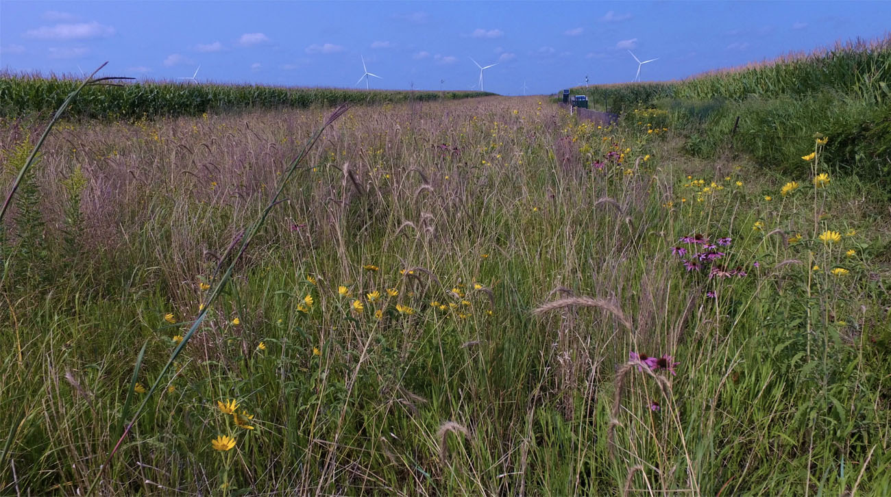
Prairie strip vegetation in the middle of corn fields operated by Mower County farmer Wayne DeWall south of Grand Meadow, Minnesota. (Photo by Mower County SWCD)
Prairie Strips: Small Investment, Big Benefits
MOWER COUNTY — Wayne DeWall grows corn and soybeans on 640 acres in the headwaters of the Root River near Grand Meadow in Mower County, Minnesota. He’s a practical land manager who has participated in the Root River Field To Stream Partnership since its inception, measuring runoff at fields’ edge and in nearby streams, using field walkovers to identify sensitive areas, and implementing conservation practices where needed.
But a fine line exists between financial goals and sound conservation goals, and like most landowners he hesitates to set aside productive crop acres if not faced with a serious need.
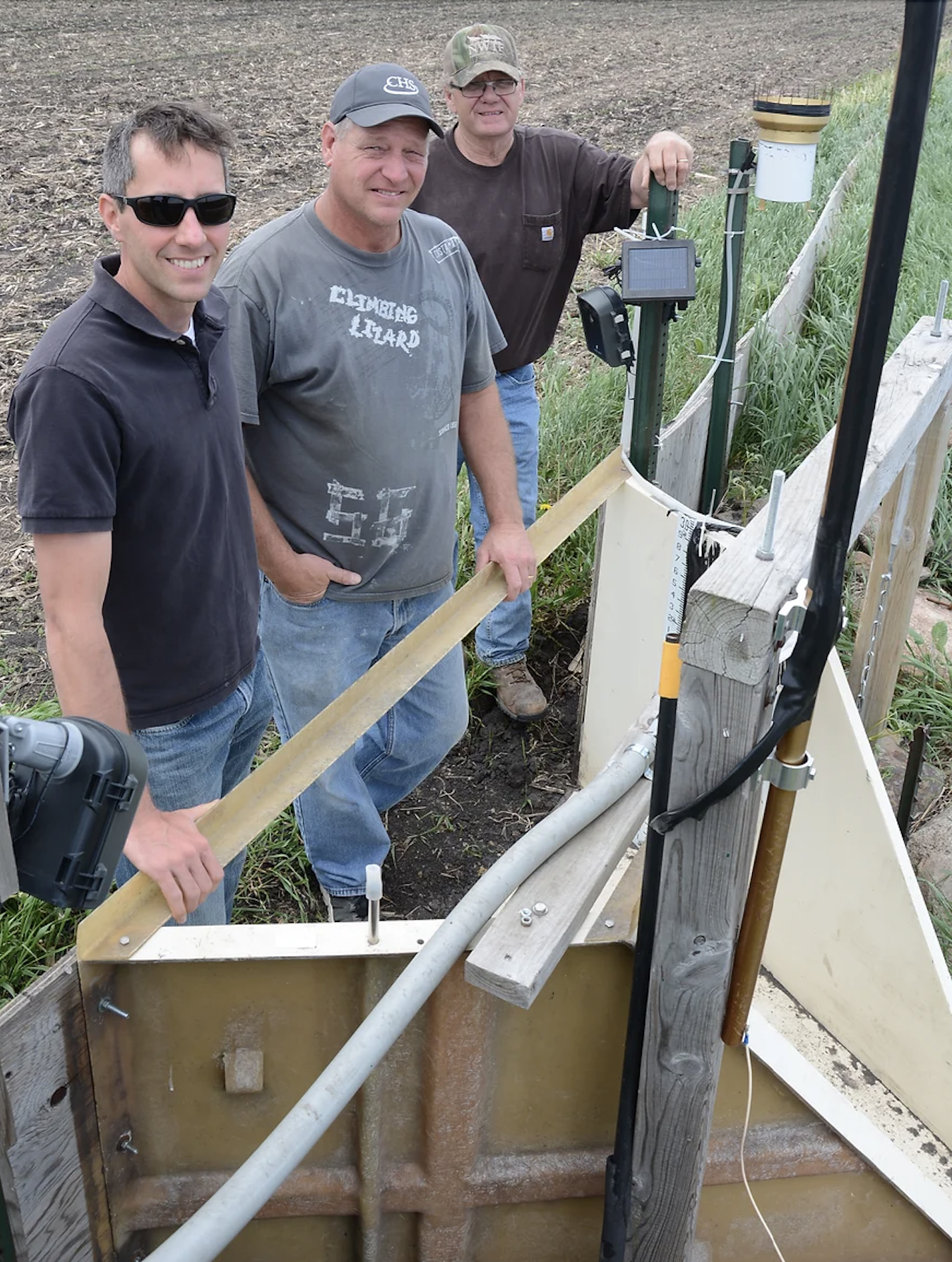
Kevin Kuehner, MDA hydrologist and researcher (left), Wayne DeWall, landowner (center), and RRFSP walkover technician Ron Meiners (right) pause at the edge-of-field monitoring station in DeWall’s field. Data collected at this station over many years is now informing on-farm management decisions throughout the region. (Photo by Paula Mohr, The Farmer magazine)
Starting in 2017, after years of baseline monitoring with the Field to Stream Partnership, DeWall began to make changes based on data. He reduced fall tillage to the use of a ripper (an ag implement used for breaking up soil), eliminated fall nitrogen applications, and eventually put in targeted prairie filter strips.
Kevin Kuehner, who leads the Root River Field To Stream Partnership and works for the Minnesota Department of Agriculture, suggested using prairie strips to address runoff after excessive rainfall on the farm.
As a result, Wayne enrolled in the Conservation Reserve Program (CRP) at his local Natural Resources Conservation Service (NRCS) office to obtain cost share for planting the prairie and to qualify for yearly rental payments.
He purchased a mix of native grasses and forbs (wildflowers) designed to reduce soil and nutrient loss, increase water infiltration and soil quality, and provide habitat for pollinators.
Seed was planted with a native seed drill. Wayne mowed the strips with a Batwing-style rotary mower the first and second years to control weeds and enhance native plant growth.
Patience and persistence, he says, are necessary.
“Year one, it looked pretty ugly. Of course, after you clipped it, it looked fine. Year two looked better. You start seeing more of the flowers coming. After that, it was something else!”
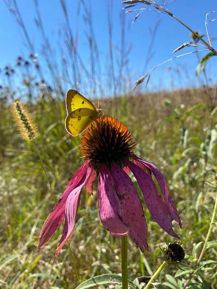
A clouded sulfur butterfly rests on a purple coneflower in the DeWall prairie strip. (Photo by Mower County SWCD)
What Exactly Are Prairie Strips?
Prairie strips strategically integrate small amounts of prairie into corn and soybean fields. Strips range from 30 to 120 feet wide and act as a sponge to slow runoff caused by rain and melting snow.
The deep roots and stiff stems of prairie plants reduce nutrient, sediment and pesticide loss, provide habitat for insects and wildlife, and yield significant benefits for soil health, water and biodiversity.
Landowners put prairie strips in high risk, erosion-prone areas such as headlands and field fence lines that act as “conveyor belts” carrying soil, nutrients and pesticides off the field. Prairie strips are highly effective in these areas, especially in April, May and June when runoff risk is highest.
They also work along heavy tree cover, where trees compete with corn and soybeans for sunlight, water and nutrients.
In Mower County, farmers frequently use crop-yield records as a planning tool to help place the strips where CRP is more profitable than farming marginally productive acres. They are also beneficial to landowners who enroll acres on their headlands, where machinery compacts soil the most.
Immediate Effect
After the 60-foot wide prairie strip was installed at the DeWall farm, monitoring results showed immediate water-quality improvement. Staff could see sediment trapped in the strip after rainfall.
DeWall uses words like “fantastic” to describe the beauty the strips have added to the farm, and the impact they’ve had on erosion. “It stopped the sediment right away,” he says. “Before, they used a squeegee to clean out the flume (in the edge-of-field monitoring equipment that measures soil movement). Now it’s always clean. That shows you right there, it’s doing what it’s supposed to be doing.”
Wayne appreciates his work with the Field To Stream Partnership and Mower Soil and Water Conservation District (SWCD) because it “allows us to be part of good science.”
He and neighbors have also worked with the Tallgrass Prairie Center at University of Northern Iowa to inspect field tile systems with a camera. Most of the time, they find that tile under prairie strips is clean, but they’ve learned to manage woody species, which can cause tile plugging.
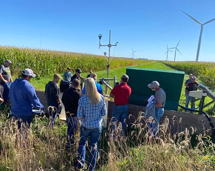
Attendees of a prairie strip field day learn about water-sampling equipment on the edge of the DeWall farm’s prairie strip. Runoff goes through the station and into a grassed waterway. The station is part of Minnesota Department of Agriculture’s Field to Stream Partnership research. (Photo by Mower County SWCD)
Catching On In Mower County
Seeing is believing, and some landowners who stop to see DeWall’s prairie strips plant their own. With local conservation agencies, the DeWalls have hosted field days. In late 2023, five farmers in northeast Mower County enrolled nearly 80 acres of cropland to convert to native prairie strips that, unlike other set-aside programs, they can turn around on and cross with farm machinery. This brings total prairie strip acres in the county to more than 100 acres in 2024.
As use of prairie strips expands, Mower SWCD is measuring new and existing practices to learn how adjusting nitrogen fertilizer rate and timing to match crop needs, and installing a prairie strip at edge-of-field will enhance economic and environmental performance for farmers.
Financial Incentives Available Now
Prairie strips can be established through CRP under a 10- or 15-year conservation contract. Landowners receive a per-acre CRP payment based on soil type, up to $300. Most costs are covered via cost-share assistance for preparing the site, purchasing seed, seeding and establishing strips.
In addition, participating landowners get up to $300 per acre annually from the federal government, and a newer annual incentive of $80 per acre through state funds.
“Anyone with cropland in the Root River or Cedar River watersheds can qualify for the additional $80-per-acre incentive,” said Jessica Bulman, conservation technician with Mower SWCD. “It’s a great opportunity for farmers, particularly because it offers so much flexibility compared to other conservation programs.”
Mower, Fillmore, Houston, Winona and Olmsted SWCD staff invite cropland owners to call, write or stop in now to learn more about prairie strips and how to obtain cost share incentives in their respective counties.
CRP projects and funds are managed through the USDA’s Natural Resource Conservation Service and Farm Service Agency. Winter enrollment allows for small amounts of prairie to be planted in-field as contour buffer strips and edge-of-field filter strips in spring 2024 or spring 2025.
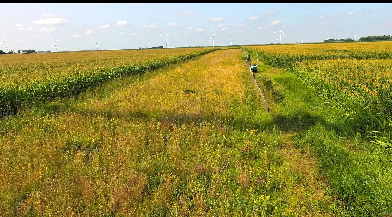
Drone view of prairie strip on the DeWall field. (Photo by Mower County SWCD)
Small Changes = Big Impact
Ron Meiners, conservation technician and Root River Field to Stream Partnership field walkover lead, says, “Weather is a motivator, and prairie strips may be the most effective, affordable erosion control practice available today for high risk runoff areas. They work in many places and are inexpensive to install.”
Iowa State University’s STRIPS research team (Science-based Trials of Row-crops Integrated with Prairie Strips) data confirms his experience. STRIPS data shows that converting as little as 10 percent of a row-cropped field to perennial prairie—in narrow patches along contours, headlands or foot slopes—can reduce sediment movement off the field by 95 percent, total phosphorus loss by 90 percent, and total nitrogen loss by nearly 85 percent.
Minimal farmland conversion is required, and by targeting areas with high conservation value and low economic return, landowners gain disproportionate environmental benefits while reducing the cost of inputs.
Says Lisa Schulte-Moore, STRIPS research lead, “Prairie strips blend conservation and production on the same acre. It’s not an either/or choice. We can have both and the benefits both offer.”
………………….
Learn More Now
What are prairie strips? | Video from Minnesota Department of Agriculture:
Prairie Strips in the Conservation Reserve Program | Info from Iowa State University STRIPS program (Science Based Trials of Rowcrops Integrated With Prairie Strips)
………………….
 Contributor
As a communications strategist and business owner for 30 years, Nancy North contributed to brand development and marketing for clients including rural and urban land and water conservation initiatives, higher education, nonprofit organizations, and Cambria and other top 100 Minnesota businesses. Nancy resides in Whalan. 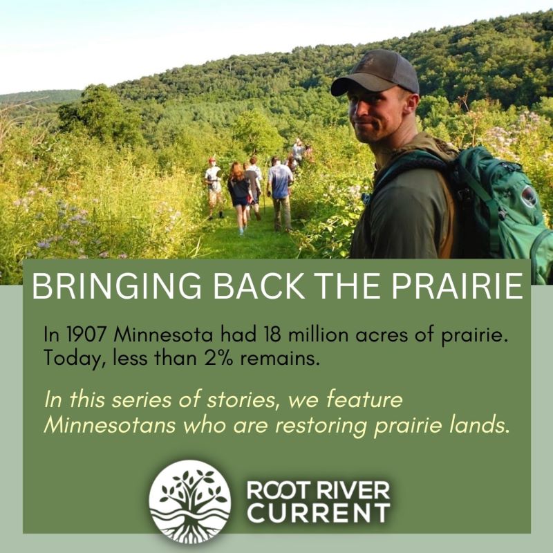
This is another in our recurring series of prairie restoration-related stories reported by Root River Current. Other stories include Bold Vision, Deep Roots: Two Southeast Minnesota Nurseries Source Seed For Restoring Native Landscapes, Rattlesnake Responders Work to Bring Timber Rattlesnakes Back from the Brink and Prescribed Burn Team Treats State Highway Ditches with a Dose of Fire.