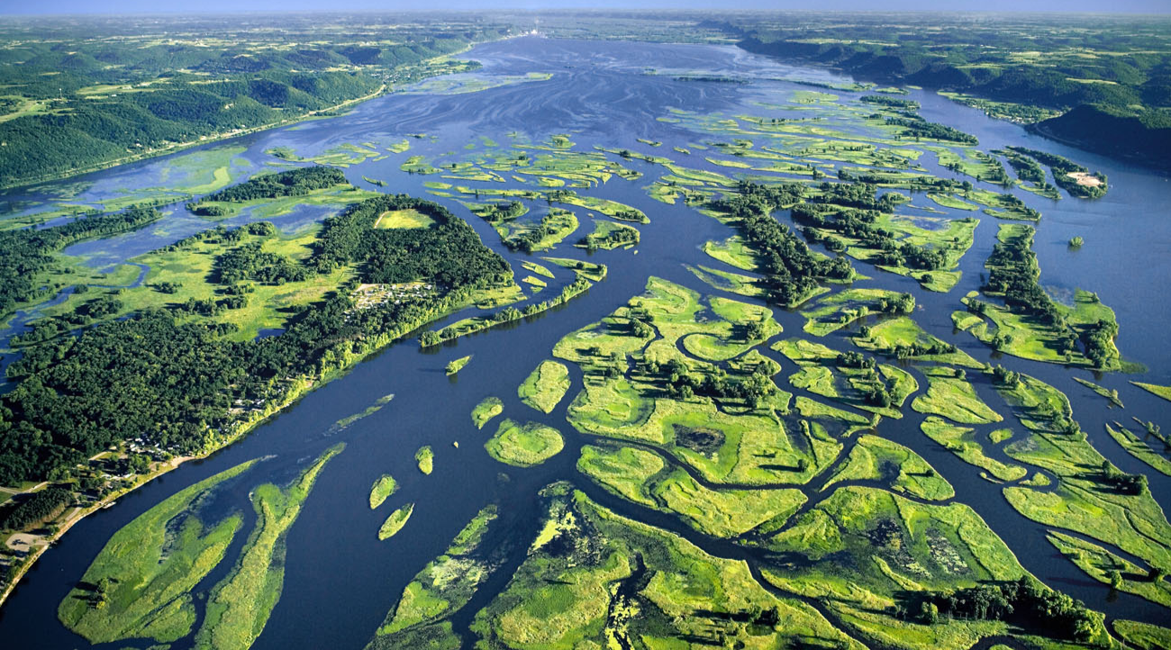
Pool 8, situated between locks and dams on either side of the Root River’s confluence with the Mississippi River, is a sprawling body of water providing wildlife habitat, boating, fishing and other recreational activities, as well as breathtaking blue and green hues as captured in this aerial photo by Houston County photographer Robert Hurt.
The Mighty Mississippi’s Locks & Dams—What and Why?
Two of the Mississippi River’s 29 locks and dams, one just north of La Crescent and the other south of Reno, help create an open body of water along Houston County’s ‘east coast’ known as Pool 8. This reservoir includes the river’s meandering main channel and surrounding tranquil backwaters. But a hundred years ago, that was not the case – in fact, spring river currents in the Mississippi a century ago would have carried watercraft downstream rather quickly. Today, it’s more like boating on a lake. Here’s why.
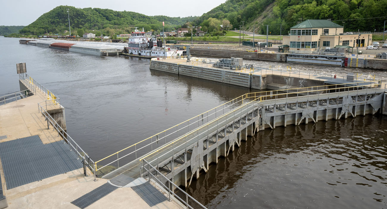
HOUSTON COUNTY – Get on a boat near the Root River’s confluence with the upper Mississippi River. Cruising in either direction you’ll eventually come upon a looming concrete structure stretching across the river’s main channel.
This concrete structure is called a lock and dam, and it’s a distinct feature of this stretch of the river. The construction of locks and dams, a major feat of engineering that occurred largely during the Great Depression, has transformed how the Mississippi River runs.
What are these locks and dams for? How do they work, who controls them, and what changes have they made to the river ecosystem?
Here’s what you should know.
Why are there locks and dams on the Mississippi River? How do they work?
Prior to the installment of the locks and dams, the upper Mississippi River was free-flowing, regularly cutting new paths — and sometimes it was so shallow that people could wade across it. The locks and dams were put in place so that boats hauling freight up and down the upper river could have easier passage.
In 1930, Congress approved a project that would ultimately create the current system: The upper river is divided into sections called pools, where a fixed amount of river is held back by a dam. The U.S. Army Corps of Engineers controls how much water is in a pool at a given time. Each pool must be at least nine feet deep to allow towboats hauling barges to move through.
The construction of the locks and dams provided work for thousands of people along the upper river during the Great Depression. River towns grew in population as temporary workers moved in. An oral history project from the 1980s notes that in Genoa, Wisconsin, near Lock and Dam 8, “Business boomed, particularly taverns,” and “Anyone having a room in a home had no trouble renting it.”
The tug Theresa L. Wood heads upstream past Genoa, Wisconsin, after locking through Lock and Dam 8. (2023 photo by Mark Hoffman, Milwaukee Journal Sentinel)
Between the headwaters in northern Minnesota and St. Louis, the river falls about 420 feet in elevation. When a boat enters a lock, the lock acts like an elevator, bringing the boat up or down to the water level of the next pool. You can also picture it like a staircase of water that boats and barges climb and descend.
Do the locks and dams control flooding on the river?
The locks and dams don’t provide flood control. Downstream from Wisconsin, there are levees meant to constrain the river away from communities and high-production farmland.
How many locks and dams are there? And what about the ‘pools’ in between?
There are 29 locks and dams on the upper river.
The corresponding reservoirs, or pools, between each lock and dam are named for the lower, southern structure holding the water back. The pool between Locks and Dams 7 and 8, for instance, is Pool 8 because Lock and Dam 8 holds back the water in that reservoir.
The first lock and dam structure, at Upper St. Anthony Falls in Minneapolis, has been closed to barge traffic since 2015. The Army Corps is currently considering the removal of the next two structures, Lower St. Anthony Falls Lock and Dam and Lock and Dam 1, between Minneapolis and St. Paul, to return the river to its free-flowing past in the Twin Cities.
The southernmost lock and dam is near Granite City, Illinois, north of St. Louis.
Why doesn’t the lower Mississippi have locks and dams?
The lower river, which stretches south from Cairo, Illinois to the Gulf of Mexico, does not have locks and dams. As major rivers like the Missouri and the Ohio join up with the Mississippi, the channel becomes deep and wide enough to naturally accommodate shipping.
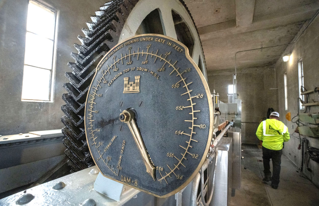
Gearing installed in the mid-1930s that controls a roller gate at Lock and Dam 8. (Photo by Mark Hoffman, Milwaukee Journal Sentinel)
Who operates them And Are they in good condition?
The Army Corps operates the locks and dams.
When the locks and dams were constructed, mostly between 1930 and 1940, engineers estimated their lifespan to be about 50 years.
The Army Corps makes routine repairs to the structures, many of which still have original parts that are now around 90 years old. From late 2023 into early 2024, for example, water will be drained from several locks and dams to make concrete repairs and address other maintenance needs. But the Corps reports that there’s an estimated billion-dollar maintenance backlog — and officials acknowledge that making fixes here and there may not be enough.
“At some point, we’re going to need some major rehabilitation of these structures,” Kristin Moe, navigation business line manager for the Army Corps’ St. Paul District, told the Journal Sentinel earlier this year.
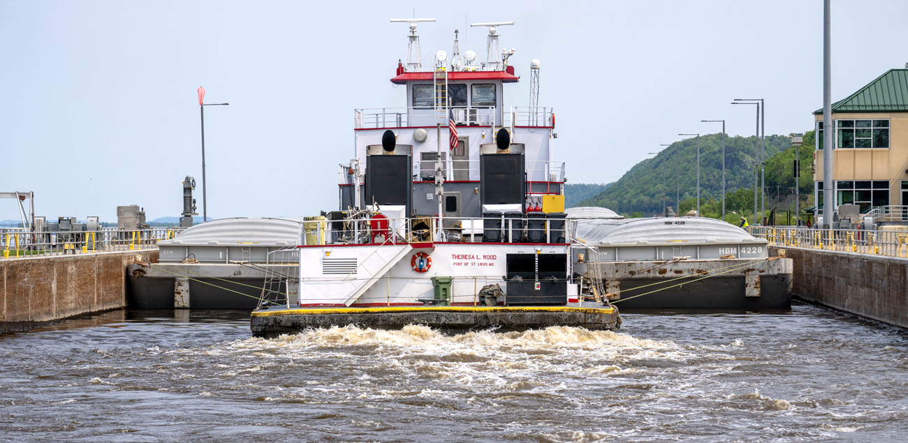
The tug Theresa L. Wood locking through Lock and Dam 8. (Photo by Mark Hoffman, Milwaukee Journal Sentinel)
Groups that represent the shipping industry contend that instead of making repairs to existing locks, the Army Corps should be constructing new ones that have a 1,200-foot chamber to more efficiently accommodate larger groups of barges than the current chambers, which are 600 feet long.
How have the locks and dams affected the river ecosystem?
Converting the free-flowing river into a series of pools has changed its natural habitats and processes. Because the dams caused more water to fill into the floodplain permanently, forest cover decreased and became fragmented, according to a 2022 study on the ecological status of the upper Mississippi.
Islands have shrunk or disappeared, attributed to wind and wave erosion across the pools, and backwater areas off of the main channel have filled in with sediment, making them less hospitable to fish. Consistent high water levels have made it more difficult for some types of aquatic vegetation to survive.
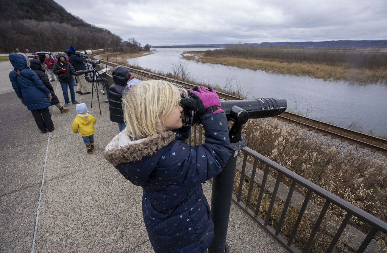
Bird-watchers gaze at tundra swans and other waterfowl on Pool 8 from an overlook near Brownsville. (Photo by Mark Hoffman, Milwaukee Journal Sentinel)
In the decades since the locks and dams were constructed, the Army Corps has completed projects to try to address some of these consequences and revitalize habitat for fish and wildlife, including building new islands and dredging backwaters to restore their depth.
…………………
Additional Root River Current stories about this stretch of the Mississippi River:
- Southeast Minnesota Runoff Pollutes Beyond Local Area; Southeast Minnesota’s nitrate pollution affects health and recreation beyond our region; Madeline Heim traces its impacts to the Gulf of Mexico.
- Efforts to Bring Back the Dying Mississippi River’s Floodplain Forests: Madeline Heim reports on hopeful efforts.
- Acorn Gathering to Save Struggling Floodplain Forests: Volunteers work to help restore Mississippi River shorelands.
- Mississippi River is Eroding Sacred Indigenous Mounds: Madeline Heim and Frank Vaisvilas report on efforts to protect ancestral sites along the upper Mississippi River.
- The Upper Mississippi River National Wildlife Refuge Turns 100: John Weiss reports on the 2024 centennial.
- Life Afloat on the Big Muddy: Boathouses along the Mississippi are explored by John Gaddo.
- Spring Rising: An essay by Ken Lubinski.
- The Mighty Mississippi’s Locks & Dams — What and Why?: Madeline Heim shares their history and purpose.
…………………
 Contributor
Madeline Heim reports for the Milwaukee Journal Sentinel and the Mississippi River Basin Ag & Water Desk. She has interned at the Wisconsin Center for Investigative Journalism and reported for the Winona Daily News.

This story is a product of the Mississippi River Basin Ag & Water Desk, an editorially independent reporting network based at the University of Missouri School of Journalism, in partnership with Report For America and the Society of Environmental Journalists, with major funding from the Walton Family Foundation.